Everyone deserves safe options to get to our world-class urban parks!
Many of Louisville’s parks, our Olmsted Parks, and even Cherokee Park have no safe way to access — unless you own a car. Safe Routes to Parks is a national initiative to give people of all ages, abilities, and income levels safe choices for park access by foot, wheelchair, bike, or bus. This applies to residents and non-residents, and frees up more car parking in parks for those who really do need to drive, without paving over our greenery and parks.
There are no sidewalks or crosswalks to Cherokee Park in our neighborhood, many sidewalk gaps, and no crosswalks, forcing people and families to walk in the streets with cars and trucks or cross dangerously.
Cherokee Park has a 36,000 foot perimeter and is 400 acres, with only one safe pedestrian entrance at Willow Park.
What would it take for the city to build sidewalks, on street walking paths, and crosswalks?
As part of the HDNA approved neighborhood plan from 2006, the Board, community, Louisville Metro, and Metro Council recommended forming “better connections to provide safer bicycle/pedestrian access to Cherokee Park” and “Form better pedestrian connections internally for Highlands-Douglass neighborhood by constructing sidewalks” on Dorothy, Eleanor, Woodbourne, Valletta, Wallace, Village, and Spring.
We support on street walking paths to create inexpensive ‘sidewalks’ on Millvale and Valletta to get people to Big Rock.
We are working to create new access to Cherokee Park and a new crosswalk with the Woodford Greenway.
We support Olmsted’s idea to expand the Scenic Loop to Big Rock.
We support the new Big Rock Master Plan that requires that “connections between Seneca, Cherokee and neighborhoods for bike, pedestrian and car shall be investigated,” and access to Gaulbert Pavilion.
Safe Routes to Parks is a national initiative to give people of all ages, abilities, and income levels safe choices for park access by foot, wheelchair, bike, or bus. See the Safe Routes Partnership and National Recreation and Park Association pages for resources.
Scenic Loop expansion concept
Crashes around Cherokee Park
Lack of sidewalks in HDNA to reach Cherokee Park (green lines are sidewalks)
Current state of Big Rock Park
Big Rock Park History
Big Rock has over a 125 year history as a park. In the early 2000’s it was redesigned, adding parking lots on either side. As part of that there were many great comments from residents and visitors and a detailed report and plan. The main “Pedestrian and Access” takeaway from the report was:
Create a safe pedestrian access route along Park Boundary Road between Millvale Road and Valletta Lane. This route could be a raised and separated lane adjacent to the existing roadway or a trail at the base of the wall along the downhill side of Park Boundary Road, or perhaps both.
Other comments include:
The traffic on Park Boundary Rd: I can see the playground from my house but rarely take my grandson there because walk is so dangerous
Heavy traffic around Big Rock makes it hazardous to run- confusing intersection-should be one way traffic
Pedestrian safety
Block parking lot off, changing it to recreational use rather that place to hold cars
A one way traffic circle or sidewalk around Park Boundary Rd.
Remove parking at end of Valetta
Poor access by foot or bike, unsafe parking
Make this road part of one lane traffic loop-ease parking too
Make it a one way loop
Big Rock in 2000
Proposed recreational bike and ped lane around Big Rock roads
Original Big Rock car parking, south side
Original Big Rock car parking, north side
Cherokee/Bonnycastle Examples
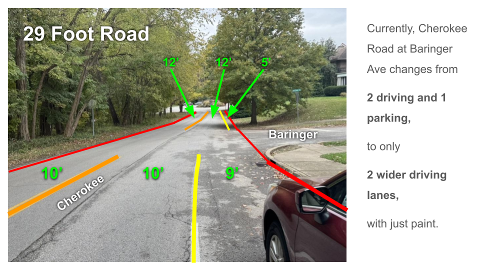
Cherokee Rd example where there are 2 lanes for driving, one for parking, that change to remove all parking - that space could be shifted to allow on street walking paths where sidewalks don't exist
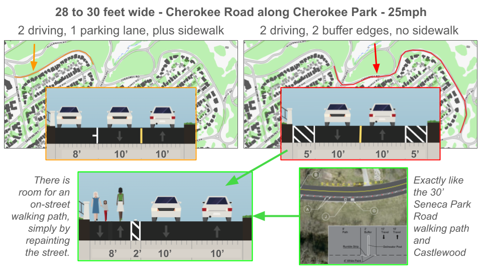
Diagram showing where one section of Cherokee Rd is striped for 3 lanes, but the next section is striped for 2, where there are no sidewalks - that space can be repainted to add walking paths
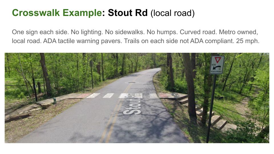
Existing Metro crosswalk example on Stout Rd, could be implemented in the Highlands